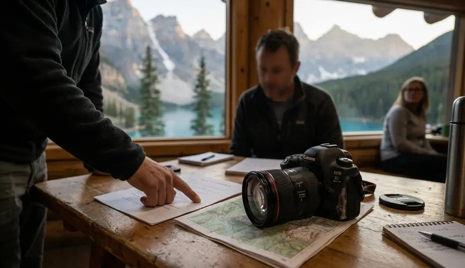
A workshop in the Canadian Rockies looks deceptively simple on paper. Sunrise at one lake, midday teaching at a second, sunset at a ridge overlook. The terrain rewards the patient and punishes the casually optimistic — and the difference between those two outcomes is almost always decided in the planning months, not on the trail.
What follows is the planning logic I use to build multi-day Rockies workshops where photographic ambition and access reliability are weighted as separate, equally serious problems.
Why Workshop Planning in Remote Mountain Terrain Often Fails
Most failed Rockies workshops I have reviewed share a single structural flaw: the photographic itinerary was designed first, and access was confirmed afterward. That order seems intuitive. It is also how a program quietly becomes fragile.
Common logistical oversights in backcountry settings
A workshop can fail even with excellent instructors if a single sunrise location requires a full parking lot, a seasonal gate, and a narrow wildlife corridor at the same time. The photographic plan collapses because every backup option is already downstream of the same access bottleneck. When roughly a third or more of planned shooting locations depend on unpaved spur roads, seasonal gates, or single-access trailheads, I flag the entire workshop as logistically fragile and rework the route before participant marketing begins.
Weather and access challenges unique to the Rockies
The window I use for access-risk review runs from mid-May through late September. Late spring snowpack closes high passes that satellite imagery suggests are open. Summer road repairs reduce two-lane approaches to single-direction pilot cars. Early autumn storms arrive faster than coastal photographers expect. Each of these alters not whether a location is reachable, but whether it is reachable on the specific morning the workshop has paid to be there.
Setting Clear Workshop Goals and Participant Profiles
Participant profiling is built before the route is finalized. The question is not who wants to attend, but who can actually photograph the terrain I have proposed without the program quietly degrading into a hiking lesson.
Matching skill levels to terrain difficulty
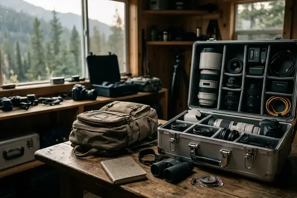
I sort guests by tripod handling speed, comfort hiking with approximately 6 kg or more of gear, and ability to work manually under changing blue hour conditions. When close to a third of enrolled participants report discomfort with around 135 m or more of elevation gain while carrying a camera pack, I build a parallel low-mobility route rather than asking the group to compromise toward the middle. Compromised middles produce mediocre photographs in both directions.
Skill surveys and sample images are collected across the early winter planning block for a summer 2025 workshop. That window leaves enough time to adjust terrain difficulty before deposits become operationally committed.
Defining creative outcomes versus technical instruction
A workshop that promises long exposure mastery is a different program from one that promises a portfolio of Rockies images, even if the locations overlap. I write the creative outcome as a single sentence before the route exists. Technical instruction — histograms, ND stacking, Nik Silver Efex Pro conversions during evening sessions, is then layered onto that outcome, not substituted for it.
Securing Permits, Lodging, and Safe Transportation
Permits, lodging, and transport are treated as one linked decision rather than three separate bookings. The preferred base is not the most scenic lodge. It is the location that keeps sunrise drives short, vehicle rotations manageable, and emergency egress credible.
Parks Canada requirements for commercial groups
Commercial-use authorizations are non-negotiable and not interchangeable between valleys. Review the current Parks Canada commercial photography guidelines before drafting any itinerary that crosses park boundaries. Parks, protected areas, and public lands can apply different commercial-use rules even inside the same mountain region, so a permit pattern accepted in one valley should not be treated as transferable to the next.
Choosing base locations with reliable access
I reject a base location if the average pre-sunrise drive to primary locations exceeds just about 45 minutes across three consecutive field mornings. The math is not about comfort. It is about how many minutes of blue hour the group will actually photograph versus how many they will spend in a van. Commercial-use, lodging, and vehicle confirmations are submitted during the early winter planning block for workshops scheduled in the 2025 peak mountain season.
EU-based participants often arrive with strong travel discipline and advanced equipment, but their first 36 to 49 hours in the Rockies may still require gentler altitude pacing, clearer liability documentation, and more explicit data-handling consent than a local weekend group. I build that adjustment into the lodging schedule, not into the apology emails sent on day two.
Risk Assessment and Emergency Protocols for Mountain Workshops
The risk plan is designed around the moment when photography attention is highest and situational awareness is lowest: blue hour, wildlife encounters, stream crossings, and rapid weather shifts. A photographer with their eye to a viewfinder is, briefly, not a participant in the landscape.
Wildlife and weather contingency planning
Based on group practice, the weather-abort protocol triggers when gust forecasts exceed roughly 55 km/h at exposed viewpoints, or when the observed temperature drop reaches nearly 7°C within about 45 minutes. Both thresholds are written into the daily briefing card, not left to in-the-moment judgment. Judgment under cold wind and rising adrenaline is the variable I am specifically trying to remove from the decision.
Emergency-role briefings run each field day in the range of 05:10 to 05:25 for sunrise departures, with a shortened repeat shortly before 19:00 ahead of evening sessions. Each participant knows who calls in, who stays with the group, and who manages the vehicle.
Communication tools in areas without cell service
Satellite messengers are carried by two assistants on separate frequencies, not pooled in one pack. Field experience revealed that single-device redundancy is not redundancy at all when the device is the one that fell in the creek.
Risk Factor: Wilderness First Aid certification covers stabilization, not evacuation. The communication plan must reach a responder who can actually arrive, not simply a contact who acknowledges the message. Verify the responder chain, not the signal bars.
Building Daily Schedules That Balance Light, Location, and Learning
The daily schedule is built backward from light, not from meal times or map distance. Sunrise and sunset locations are assigned first. Mid-day teaching, scouting, rest, and critique are inserted afterward, where they fit the participants' energy curve rather than where they fit the organizer's preferred rhythm.
Golden hour timing across multiple valleys
For a mid-summer Rockies schedule, valley-specific golden-hour movement is modeled across an early July field week. Sunrise assignments may need to shift by roughly 20 to 30 minutes between east-facing and west-facing locations during that window. The shift is small on a spreadsheet and decisive in the field — a 20-minute miscalculation is the difference between photographing first light on a peak and photographing the gray flatness that follows it.
Integrating critique sessions without losing momentum
Formal critique is limited to roughly a sixth of waking workshop hours on field days. Beyond that threshold, the program drifts from practice-led into classroom-led, and the Rockies become a backdrop rather than a subject. Evening Nik Color Efex Pro demonstrations are scheduled as optional, not mandatory, because participants who chose a five-day field workshop did not choose a five-day software seminar.
Critical Insight: Group feedback indicates that the workshops participants remember most clearly are not the ones with the most locations, but the ones where the schedule respected their fatigue. Light is the headline. Pacing is the structure that lets the headline land.
The planning approach above reflects how I currently sequence Rockies programs; mountain conditions evolve year to year, and any specific access threshold should be re-verified against current park advisories before participant materials are finalized.


Reader Comments
The conversation starts with you.
Your Comment